Saturday 25 February 2017

Books on Milton Keynes History

There are some excellent books to be found in Milton Keynes libraries (and not just the local studies section in the Central Library) – about the history of the city.
I’m currently borrowing (fear not, there are multiple copies) – three excellent books – which are aiding my research. I will be putting the results up on this blog.
The three books are
OLYMPUS DIGITAL CAMERA
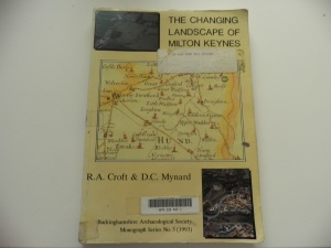
The Changing Landscape of Milton Keynes – R A Croft and D C Mynard.This has a chapter by R J Zeepvat on the geology and topography of this area – an essential for understanding our city’s past and present; Descriptions of the area at different periods. [Prehistoric; Roman; Saxon; Medieval and Post-Medieval]; a chapter by M Gelling on place-names of the Milton Keynes area. It concludes with a series of parish essays – focusing on discoveries made in the old parishes of our city.
OLYMPUS DIGITAL CAMERA
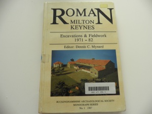
Roman Milton Keynes: Excavations & Fieldwork 1971-82 – edited by Dennis C Mynard. It has some excellent maps; drawings and lists of finds. There are also a set of photographs.
OLYMPUS DIGITAL CAMERA
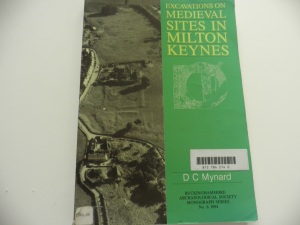
Excavations on Medieval Sites in Milton Keynes – also by Dennis Mynard in the Buckinghamshire Archaeological Society Monograph Series. This too has some excellent diagrams & drawings; photographs and descriptions of the major sites.
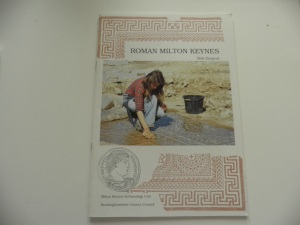
I have my own copies of two excellent books – R J (Bob) Zeepvat’s “Roman Milton Keynes” which has chapters on Iron Age Background; The Roman Occupation; Roman Government; Towns; Communications; Countryside; Villas; Trade & Industry; Religion and Burial – and Further Reading.
OLYMPUS DIGITAL CAMERA
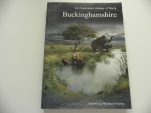
and “An illustrated History of Early Buckinghamshire” edited by Michael Farley – which describes the area and puts it into a wider context.
OLYMPUS DIGITAL CAMERA

Tuesday 21 February 2017

Milton Keynes History

Last month the city of Milton Keynes celebrated its 50th birthday - but the area has much of historical interest. It is overlooked by the iron-age fort of Danesborough, includes the Roman settlement of Magiovinium, a Roman villa, the historic Watling Street coaching town of Stony Stratford, Bletchley Park and transport routes from across the ages (Watling Street, Grand Union Canal, Railway, M1). It includes a number of ancient villages and the historic towns of Bletchley, Stony Stratford, Wolverton and Newport Pagnell.

In this and subsequent posts, I will share something of that history. There is an excellent map called "Milton Keynes Heritage". I believe that it may still be available from the Visitor Information Centre in Centre:MK [the huge indoor shopping centre]


I've always believed that to understand the history of an area, it is necessary to study its geography. Milton Keynes is built on a low plateau, crossed by three rivers.

The biggest river forms the Northern boundary of the city itself, then crosses through some of the rural parts and through the town of Newport Pagnell. The Great Ouse runs 143 miles from its sources in Northamptonshire (near the village of Syresham), through Brackley, Buckingham, Milton Keynes, Olney, Bedford, St Neots, Huntingdon, St Ives and Kings Lynn before entering the Wash. The Treaty of Alfred and Guthrum - which settled the border between the Anglo-Saxon kingdoms and Danelaw ran along the Great Ouse between Stony Stratford and Bedford.

The second river is the Ouzel (also known elsewhere and in other eras as the Lovat). It rises not far from Whipsnade Zoo - and flows through Leighton Buzzard and through the city close to the site of Magiovinium; past the Open University, meeting the Great Ouse in Newport Pagnell.

The third 'river' is a brook - but it has carved out a pleasant valley which is partly used by the railway. Loughton Brook rises a little outside the City to its south west. It flows through the estates of Tattenhoe Park, Tattenhoe, Emerson Valley, and Furzton - where it feeds Furzton Lake, past the Milton Keynes (National) Bowl, Knowlhill (where the Teardrop lakes are), Loughton, past Bradwell Abbey and close to the Roman Villa in Bancroft, eventually meeting the Great Ouse in New Bradwell.

Saturday 18 February 2017

Gloucester Cathedral


If you've watched the Harry Potter films, you might recognise the cloisters of Gloucester Cathedral. But it has played an important role in history long before that film series was conceived.

In 1085 William the Conqueror, at a meeting in Gloucester of his Great Council, commissioned the Doomsday Book. Some believe that the cathedral (or at least an earlier version of it, as a monastery) was the venue for that meeting.

Edward II, is buried in the Cathedral. He had been deposed and was being held at the nearby Berkeley Castle. His very convenient death is regarded by some as a murder. Many visitors have come to see his tomb, included the similarly ill-fated Richard II in 1378.
[George Marchant, who I met while visiting the cathedral, has written a short book called "Edward II in Gloucestershire", available in the Cathedral ]

The Cathedral was ancient at the time of those events. It was first established as a religious institution in the Seventh Century. by Osric, King of the Hwicce tribe (It is also claimed that he established what is today Bath Abbey). It became a Benedictine monastery in the early 11th Century.

It is a very nice cathedral to visit - in fact I made two visits while we were in this ancient Roman city last year.

Thursday 16 February 2017

The Rathaus, Hamburg


When I visited Hamburg for the first time, I was with a group of young political activists - visiting and staying with members of our sister party in Germany. The most unoriginal joke that was repeated on that trip concerned the name of the building in the picture. The Rathaus (Rat - Advisory Assembly, Parliament - as in Bundesrat) is the city hall - so the joke was about a house for rats (politicians).

It is a beautiful building - and I have many photographs of it. I sadly didn't have time to tour it on last July's visit - but next time!

Outside is the Rathausmarkt. Our visit coincided with an outdoor film festival. While waiting for the late night film to start, music was played through the loudspeakers. I really enjoyed the selection of French music that played. There were food and drink stalls around the square - selling food from the various traditions within Europe. The audience was also made up of people from many nations. Less than two decades before I was born, bombs brought by aircraft built in the region of my birth had been targeted on this city. Small plaques on the streets of Hamburg commemorate the people who had once lived there - but were taken away to concentration camps, from which many never returned. A moving statue outside the Bahnhof Dammtor recalls the Kindertransport - which brought many refugee children to Britain in the months preceding the outbreak of World War II. It was a timely reminder of how much had been achieved in the 20th Century after evil had visited our continent. A reminder of why we mustn't let history repeat itself.


Tuesday 14 February 2017

Hamburg Part 3


This is the model of medieval Hamburg - a densely populated which had become of the world's important trading centre. In 1381 Hamburg became part of the Hanseatic League. This trade alliance dominated trade in the Baltic and North Seas. The word 'Hansa' comes from the Middle Low German word for 'convoy'. The German airline 'Lufthansa' incorporates the word. (air convoy).

The Hanseatic League features in a book about the history of the North Sea.


During my visit I took a couple of cruises along the Elbe - one in the evening, with a meal with delegates from the conference my wife was attending, and the other during the day. I also used the U-bahn to get around the city and see some of the other sites. I look forward to returning to Hamburg - with not quite as long a gap as previously. [I had stopped in Hamburg for a very short stay back in 1978]. There is so much to see - and it is a very pleasant city.

Saturday 11 February 2017

Hamburg Part 2


My last post showed a photograph of the model of the earliest fortifications of Hamburg  -
 this is a photograph of the Hammaburg in all its glory.

It didn't last long. In 845 the Vikings razed the fortress, and little was left of the town. However in the 10th Century a new fortress was built and the city grew rapidly. It was awarded market rights in 937, which settled its future as a trading centre.

On my visit last July I spent a couple of days walking around the Old town. Much of it is modern - but not mainly because of bomb damage during World War II, but because of the Great Fire of 1842. But equipped with a couple of good guidebooks, and what I had learnt at the Hamburg Museum, I was able to appreciate the ancient history of Hamburg.


The city grew - and extended from the 'Old Town' (Altstadt) into what is now called the Neustadt (New Town). The old city walls are now gone - but the north and west edges of the town were turned into parks in the 19th Century. These are a pure joy to walk through.

Public transport is excellent within the city.  HVV tickets are valid  on bus, rail, metro (U-Bahn & S-Bahn) and the harbour ferries.

Thursday 9 February 2017

Hamburg Part 1


Last summer my wife and I spent a week in Hamburg. She went for an academic conference - I went to carry our bags and to explore the city of Hamburg.

There has been human settlement in Hamburg, as with many places, for thousands of years. Nomadic hunters were in the area from at least 8,000 BCE. More permanent settlements were established by Saxon tribes in the 4th Century (CE / AD). However it was with the establishment of the 'Hammaburg', a massive fortress, by Louis the Pious (a son of Charlemagne), that Hamburg as a town came into existence.

Hamburg sits today on a branch of the great European river, the Elbe. The Hammaburg, and the town that grew around it, sat on a hill overlooking the Alster, a river which runs for 53 km, is dammed within the city to form the Außenalster and Binnenalster lakes, before meeting the Elbe. The fortress was located south of today's church of St Petri.

On one of my days in the city, I visited the Hamburg-Museum. It is WELL worth a visit. I particularly liked the models of the town as various periods (see the example above).  It's website is http://www.historische-museen-hamburg.de/en/en [English version - see the tabs]


Tuesday 7 February 2017

Leicester

Last week I was able to pay a day's visit to Leicester. It's a city I love - and have many happy memories of over the last 35 years.


The discovery of the body of Richard III has made the city an international tourist attraction. He has been finally laid to rest in the Cathedral - and an impressive visitors centre has been set up across the street (where his body was found in the carpark). Well worth a visit if you are interested in British history. The battlefield of Bosworth is not far from Leicester - and it too has a visitor's centre which excels at bringing history alive.

But there is more to Leicester than Richard III. It was an important Roman town. The Fosse Way ran from Exeter to Lincoln via the town of Ratae Corieltauvorum. Some of the remains are still visible - and there's an exhibition at the Jewry Wall Museum.

Around the city are newly installed interpretation boards which tell the history of the city through the ages. I learnt a lot last week.


Friday 3 February 2017

Roman London

There is an excellent App available for iPads from the Museum of London - which superimposes a map of Londinium upon the modern street map of the British capital. It also highlights were archaeological finds have been made. It is available in the Apple App Store as "Streetmuseum: Londinium"

The map is also available as a printed map.


For a modern city, it is amazing what can still be seen. I would thoroughly recommend a visit to the Museum of London - the gallery on Roman London has been superbly designed to give the visitor an understanding of both the general picture of Roman London as well as specific aspects of life in that busy city. The website can be found at http://www.museumoflondon.org.uk/museum-london. It is within easy walking distance of St Pauls and Moorgate underground stations.

Much of the wall which was first built by the Romans has disappeared - but its route can be followed. Some sections still stand. If you walk from Tower Hill underground station towards the tower you will see a significant part of the original Roman wall. I've walked the walls many times - but now that I'm reading this book - I will be rewalking it shortly


Underneath the Guildhall are the remains of the amphitheatre. Further details are available here.

The city was built around two hills. St Paul's Cathedral sits atop Ludgate Hill - and many Roman remains have been found in the area - particularly when Paternoster Square was redeveloped. Leadenhall Market stands on Cornhill - the other main hill, upon which the Roman Forum and Basilica were built.

Between the two hills were the valley of the River Wallbrook (sometimes spelt Walbrook). Excavations there (particularly at Bloomberg Place which is now close to completion  - do see the archaeological blog at https://walbrookdiscovery.wordpress.com)