Saturday, 8 April 2017

The Roman Roads of Milton Keynes

Watling Street is the name given later for the major Roman road (which may actually follow a more ancient route) which ran from the ports in Kent (Dubris (Dover) and Rutupiae (Richborough)), via Londinium (London), Verulamium (St Albans) onto Viroconium (Wroxeter). It then splits, continuing what may be more ancient routes towards Holyhead and Deva (Chester). The Antonine Itinerary, Route II extends the route beyond Deva to Hadrian's Wall.

In Milton Keynes, it enters the current boundary of the Unitary Authority at the roundabout on the A5 trunk route where it meets A4146. It runs through Fenny Stratford to the 'Roman' roundabouts near the Bletchley Tesco. It runs alongside Bletcham Way and the start of the V4 near the MK Dons Stadium, on Denbigh Road. It then follows the V4, which diverts to avoid the original route of Watling Street through Loughton and Stony Stratford. In Stony Stratford, Watling Street is the London Road and High Street. Watling Street exits Milton Keynes as it crosses the Great Ouse.

On its route it crosses a number of streams and the Great Ouse on bridges, but these were probably fords in Roman times.

There were other Roman roads in the area. The Bletchley to Buckingham road is believed to be of at least Roman foundation.  


"Viatores" is the name used by a number of scholars who published a book in 1964 which sought to identify possible Roman roads in the South East Midlands. Some of these roads are definitely Roman - but others are conjectures based upon known settlements, parish boundaries and previous archaeological finds. I'm not in a position to evaluate how much of work has been proven by later research - but the book is a useful starting point.

MKi Observatory used to have a Heritage Theme which showed the Viatores routes relative to the modern roads and paths. I have not been able to find it recently, but if anyone can provide a link - please share it with me. I do recall that one route crossed the southern end of Milton Keynes Central railway station, crossing Loughton towards Shenley Brook End near to the current route of Child's Way. The picture below shows the Viatores routes in the general area.


Route 175 heads for Irchester via Olney. following the course of the River Ouzel.

A copy of "Viatores" can be consulted in the main Milton Keynes library.


Tuesday, 4 April 2017

The Bancroft Villa

It's nice to cycle up from our home in Furzton to Bancroft. The Redway follows the Loughton Brook, past some of the balancing lakes created to reduce flooding in that valley. Once past the concrete cows, the stream winds its way through Bancroft, with a footbridge linking to the western side - and the Roman Villa.

Fragments of Roman pottery were found by the stream fifty years ago. Major excavations took place between 1973 and 1978, directed by the Milton Keynes Archaeology Unit. Initially the site was backfilled and allowed to grass over. Then it was proposed in 1981  to create a full-size reconstruction of the villa at its most magnificent with a visitors centre and museum. Sadly these were the austerity 80s, and the ambitious plan was dropped. However further excavations were funded - covering an area of about 12,000 square metres.

The results of that excavation are set out in a two volume Monograph by R J Williams and R J Zeepat.


The earlier posts on Bronze Age and Iron Age Milton Keynes have already mentioned the settlement at Blue Bridge/Bancroft. It seems likely that the farmers there moved down the hill to the visible site of the villa. While the foundations of the main building are visible, the outbuildings lie buried underneath the open space between the roman remains and the pétanque piste to the north.

Where the Bronze and Iron Age settlement lay, a mausoleum was built. It continued in use, probably until the villa itself was abandoned in the fourth century CE (AD).

There are some excellent interpretation boards by the main villa building. The site was developed from the early years of the first century. We believe that the first farm (villa) on this site was constructed in the late first century. This was occupied until a fire destroyed mainly of the buildings in about 170 CE (AD). A large Roman style house was was built in the late third century - but there is no evidence that it was a farm. It was in the fourth century that the villa reached its full extent and glory. Clearly its inhabitants had become very prosperous.


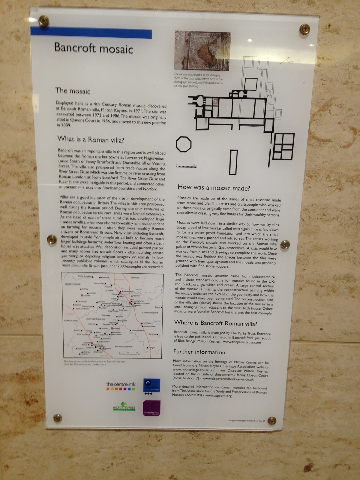
The main residential building was decorated with mosaics. One of these is currently on display in the Milton Keynes shopping area (Centre:mk) - close to the toilets in Deer Walk (Entrance North 9). In front of the villa is a fishpond - and the room layout is explained on the interpretation boards and can be seen on the ground.


Tuesday, 14 March 2017

Magiovinium

Watling Street crosses the River Ouzel close to Dobbies Garden Centre and the Bletchley Rugby Club (Manor Fields). Along the Roman road was a small town with buildings, (possibly some were shops) and a cemetery outside the defences of a bank and ditch. This is on a spur of land which gently slopes down to the Ouzel.


There have been a number of small excavations - starting in 1911 by Bradbook and Berry. In 1964 there were excavations of a bathing station, and a number in the 1970s to 1990s associated with the roadbuilding in the area.

(see for example the reports on the Little Brickhill by-pass, 1989-90 (link here) or the excavations that preceded the construction of the garden centre (link here))

A Roman coin manufacturing site was discovered in 1990, beneath the line of Galley Lane (the A4146), adjacent to a mid first century fort. Those coins are now on show in Room 49 (Roman Britain) in the British Museum. Two separate groups of coins were found, one set were fourth-century bronzes and the other were second century denarii.


The fort, a double-ditched rectangular enclosure, is likely to have build during the reign of Nero, and abandoned within 30 years. It is situated in the field which is bordered by Watling Street and Galley Lane (A4146)

Saturday, 11 March 2017

Roman Milton Keynes

Watling Street (though the Romans did not call it this), is the most obvious sign of the Roman presence in Milton Keynes. It enters Milton Keynes at the large island at the south of the A5 trunk route and is still in use through Fenny Stratford; closely passing the Tesco in Bletchley and as 'Denbigh Road,, parallel to Bletcham Way to the start of the V4. This modern road follows the original route (except to avoid Loughton (where the London Road follows Watling Street) and then along the High Street in Stony Stratford.


The Roman villa at Bancroft is also well known, but is not the only villa found in the area. A map in Bob Zeepvat's "Roman Milton Keynes" identifies villas in Holne Chase, Sherwood Drive (both Bletchley), Dovecote Farm in Shenley Brook End, Wymbush, Stantonbury  and Stanton Low. He also  notes that a site in Walton could be a villa and that the Ouse valley "is also particularly well endowed with villas, which occur at intervals of 2-3 kilometres along its north side." The term means farm - and some villas are really a collection of buildings dominated by a place of residence. The book on Bancroft shows that the extent of buildings covered most of the land between the open remains of the villa and the car par and the pétanque pitch. Wymbush's villa included a stone house and outbuildings including a barn. The picture above was taken at the British Museum and is of coins found near Watling Street as it enters Magiovinium (the Roman town mow within Milton Keynes).


Detailed lists of sites and findings are listed in Roman Milton Keynes: Excavations & Fieldwork 1971 - 82 edited by Dennis C Mynard.


An interesting book was published by the Museum of London Archaeology Service called "Becoming Roman". It traces the development from the late iron age to the end of the Roman period at Monkston.


All these publications are available in the Milton Keynes Libraries. The Main library in Silbury Boulevard has an excellent local studies sections sited within the Reference Section (though some can be borrowed).

There's a good interactive resource available at http://www.mkheritage.co.uk/mkm/mkarchaeology/Web%20pages/roman1.html

Tuesday, 7 March 2017

The Iron Age in Milton Keynes

I live in Furzton - a modern estate (with a beautiful lake - itself constructed in recent times). Yet I live very close to the site of a settlement which was inhabited during Iron Age times. So do many other people living across Milton Keynes. The archaeologists have found lots of evidence of Iron Age people across the city.

The Iron Age covers the period from around 800 BCE until the Roman invasion of 43 CE (AD). Of course the transitions between the Bronze Age prior to the Iron Age, and the Roman era following it were more gradual than sudden.

There were two settlements in Furzton. The first (probably) was close to the stream - close to where Loughton Brook becomes the Lake. The longer term settlement was just off Dulverton Drive, about 400 metres from the stream side site - and this was excavated in 1987 and 1988. [Full details can be found in the South Midlands Archaeology Journal 1986, 1987 & 1988 - available to download here] This was probably a stockade for animals, with some evidence of human settlement. The weather & the resultant water within the clay made, by all accounts, for a difficult excavation.

Was this an offshoot of a tribal sub-capital at Danesborough? or an unconnected development? Danesborough is scheduled as an Ancient Monument  because it is thought to be of national importance. It has survived well and is a good example of an Early Iron Age fort. It was excavated in 1924. The shape can be described as roughly oval or rectangular with rounded corners. It would have given an extensive view northwards towards Newport Pagnell and Olney - and most of the modern city of Milton Keynes. The local tribe were the Catuvellauni, whose tribal capital was just outside Wheathampstead (which I hope to be writing a post about shortly) and then what is now St Albans.
We don't know whether Danesborough was merely a defensive position or a local centre which was to be eclipsed by the Roman town of Magiovinium.

The settlement at Blue Bridge from the Bronze age seemed to have been in continuous use through the Iron Age.


Pennyland was also home to an Iron Age Settlement. This is described in "An Illustrated History of Early Buckinghamshire"

 and in greater detail in "Pennyland & Hartigans" (which also identifies iron age settlements in Hartigans gravel pit (in the area between Little Woolstone and Milton Keynes Village) Woughton, Wavendon Gate, Caldecotte and Westbury by Shenley)


A 2005 excavation in  Tattenhoe Park also uncovered evidence of a settlement there. That report can be loaded from here.

Just outside Milton Keynes, in Little Horwood parish, the "Whaddon Chase hoard" was found in 1849, containing coins from the period 55-45 BCE.

Saturday, 4 March 2017

Milton Keynes' Bronze Age

The Bronze Age roughly covers the period 2300 BCE until 600 BCE. In reality these dividing lines are not as clear cut as we sometimes imagine. It is the introduction of metalworking in bronze (and also copper and gold) which defines this period - until iron becomes the major type of metal being worked. Another characteristic of this period was a distinctive style of burial involving decorated pottery (giving rise to the name 'beaker culture).

The evidence of Bronze Age settlement  has largely come from excavation of ring ditches in the Ouse and Ouzel valleys.  These are associated with burial mounds (Round barrow). The most significant finds were at Warren Farm (Wolverton Mill) - which may be the oldest; the nearby Little Pond Ground, Oakgrove and Cotton Valley (between Willen Lake North and M1 Junction 14).

There's an excellent piece about the settlement at Blue Bridge/Bancroft accessible at http://www.mkheritage.co.uk/mkm/mkarchaeology/Web%20pages/Bronze%20Age.html. The pottery is of bronze age type, but the buildings are closer to Iron Age types.

A number of Bronze Age artefacts have also been found in Stony Stratford (a socketed axe): Shenley (an urn and an arrowhead) and other sites around the city.


Near Newport Pagnell (Gayhurst Quarry) an early Bronze Age cemetery has been excavated. It had seven round barrows. At the centre of the largest barrow was a massive grave pit which showed a sequence of five successive burials from around 2000 BCE, while the six surrounding ones were 100 and 600 years later. The Illustrated History of Early Buckinghamshire  says "What made this barrow remarkable was a deposit of cattle bones, perhaps the remains of 300 animals...The overall scale of the bone deposits provides as vivid an indicator of the wealth of the community that could afford to make this exceptional statement as the deposition of any number of artefacts. It illustrates the central importance of both cattle and ritual sacrifice to early Bronze Age communities"


The British Museum has the "Milton Keynes Hoard", an incredible hoard of Bronze Age gold found in 2000 in a field near Monkston. It has been described as "one of the biggest concentrations of Bronze Age gold known from Great Britain". A hoard of weapons was found on what became the County Arms Hotel in New Bradwell. 


Wednesday, 1 March 2017

The Stone Age in Milton Keynes.

At school we were told about the Stone Age. (To a young mind an 'age' might seem equivalent to any other 'age' - but the Tudor Age lasted 118 years. The Stone Age around 700,000 years) - There's an excellent account of the different periods within the 'Stone Age' in "An illustrated History of Early Buckinghamshire" - edited by Michael Farley. The Palaeolithic (Old Stone Age) covers most of the period - and includes time when ice covered Milton Keynes. The Mesolithic (Middle Stone Age) covers the period 9000 to 4000 BCE, and the Neolithic (New Stone Age) can be divided into the Earlier Neolithic 4000 BCE - 3250 BCE and the Later Neolithic 3250 BCE - 2300 BCE.


We don't really know much about human activity in the Milton Keynes area during the Palaeolithic period. Several flint hand-axes have been found in gravel pits in the Bletchley area, and flint tools from around 12,000 BCE were found in a quarry at Manor Farm, Wolverton - but as R J Williams wrote - " Unfortunately there is no correlation between the distribution of palaeolithic artefacts and the faunal remains in the area, as all have resulted from chance discoveries, so it has not been possible to identify any pattern of activity for this period."

Significant quantities of Mesolithic flints have been found in the valley's of the three main rivers (see post from 21st February) - the Great Ouse, the Ouzel and Loughton Brook, with concentrations at Bancroft, Little Woolstone and what is now Caldecotte Lake. Mesolithic axes have been found a bit further away from the River Ouzel at Walton and Pennyland, which Williams suggests, " may indicate Mesolithic penetration into the woodland and perhaps the beginnings of woodland clearance on the heavier clay soils away from the river rallies."


With more settled lifestyles coming with the Neolithic age - we have greater evidence of people living permanently in the Milton Keynes areas. What is believed to be a neolithic Cursus was revealed in an extension of the quarry at Manor Farm, Wolverton.


 Before the Roman villa at Bancroft was built, there was neolithic activity on Blue Bridge. At the very end of the period Stacey's Farm area (now Milton Keynes Museum) saw some farming. Other settlements have been identified at Heelands (around 2500 BC) and Secklow